Tuesday, July 26, 2005

Hands On Your Head. Don't Move! Down On Your Knees. Cross Your Ankles!

Image of handcuffs.
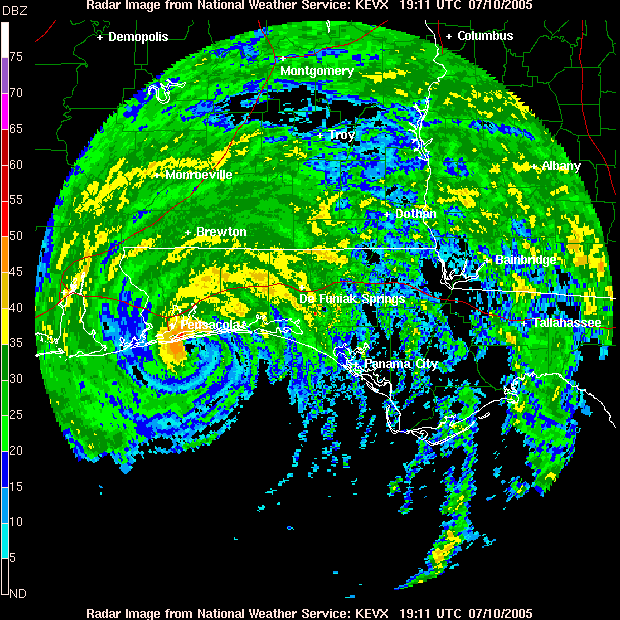
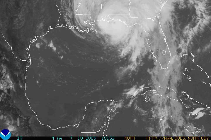
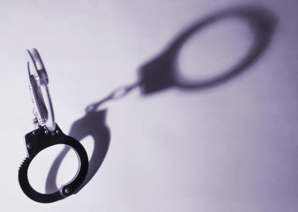
No that's not a scene from COPS. But it could be a scene from Pensacola Beach.

It will probably be heard more that once since Pensacola Beach is now open.

When the barrier island was finally reopened (to the general public) after Hurricane Ivan, it was reported that there was some looting taking place. There were reports of people driving or walking up to other peoples property and just looking in and taking things out of damaged homes. I read a posting on the Pensacola News Journal Community Forums that the Police weren't always around (or around at all for that matter) to catch these thieves.

Don't get me wrong, the Police do a good job but can't be everywhere all of the time.

When people lose possessions in a disaster, the things that are left over become all that more important to them. Maybe it is because that is all they have left. You don't realize how important something is to you until you have lost it.

So please, respect other's property. Don't go looking in damaged structures "just for a look". You would not want strangers to come looking around your house or condo, so please don't go looking around other peoples stuff.

The world needs a little more respect for each other and Pensacola Beach would be a great place for it to start.

Remember, you never know who might be watching you! You may find yourself wishing it was the Cops.

Blogler

Saturday, July 23, 2005

Pensacola Beach To Open To General Public 6:00 A.M. Sunday, 7-24-2005


Click for a larger picture.
Photo from June 20, 2004, Casino Beach, Pensacola Beach FL.

The famous white sand beaches of Pensacola Beach (PB) will open to the general public starting at 6:00 a.m. CDT Sunday for the first time since Hurricane Emily made landfall just East of PB July 10, 2005.

Parking on PB will be limited to Casino Beach and Quietwater Beach parking lots. Also of note is that there is no gasoline available on the island. The Pensacola Beach Fishing Pier will remain closed until further notice.

The Lifeguard towers at Casino Beach were destroyed by Hurricane Dennis. The towers are being rebuilt and three are expected to be operational by Sunday.

Sandy Johnston, executive director of the Pensacola Beach Area Chamber of Commerce stated "We expect to be really busy this weekend and next weekend. These are the last two weekends before school starts, so we expect a lot of people will be trying to get to the beach for one last visit."

Buck Lee, General Manager of the Island Authority said that sand at Casino and Quietwater beaches have not been sifted but have instead been spot checked for debris. Mr. Lee said sifting of these beaches will occur later, but he gave no time table on when this will occur.

Bob West, Pensacola beaches public safety director said that Lifeguards have been swimming at the two main beaches to remove debris that they come across at the surface. Public Safety Director West said "We'll have the bulk of debris out of water by Sunday, but it wouldn't surprise me if there was some more out there."

Areas outside of the two main beaches mentioned above probably are more dangerous to swimmers and beachgoers and footwear is recommended to be worn at all times both on the sandy beaches and in the water.

Also, please be aware of rip currents, which are now more dangerous due to shifting sandbars in the area. Here is some information from HOWSTUFFWORKS.COM on rip currents and how to deal with them.

Wednesday, July 20, 2005

Hurricane Emily Makes Landfall

Below is a infrared satellite image of Hurricane Emily as it made landfall on the Mexican coastline at approximately 7:30 am ET July 20, 2005. Image is courtesy of The Satellite Services Division of the National Environmental Satellite, Data, and Information Service, which was posted at 15:15 pm UTC July 20, 2005.

Hurricane Emily at landfall on Mexican coastline July 20, 2005

Hurricane Emily made landfall approximately 75 miles South-Southwest of Brownsville Texas with winds of 125 mph.

As of 10:00 am CDT Emily was moving toward the West at approximately 10 mph, with this path expected to continue for the next 24 hours. Hurricane force winds extend outward from the center of the hurricane about 70 miles. Maximum sustained winds are at 105 mph.

5 to 10 inches of heavy rainfall is expected over Northeastern Mexico. Rainfall amounts of 2 to 4 inches are expected over Southern Texas and the lower Rio Grande valley.

Monday, July 18, 2005

NOAA Reports Emily Weakened After Crossing Yucatan Peninsula, Now In Open Waters

Below is a infrared satellite image of Hurricane Emily courtesy of The Satellite Services Division of the National Environmental Satellite, Data, and Information Service posted at 1:00 pm CDT July 18, 2005.

Hurricane Emily as of July 18, 2005

Hurricane Emily crossed over the Yucatan Peninsula overnight and has re-entered the Gulf of Mexico. Land strike predictions indicate Emily's next landfall will probably be on the Mexican mainland.

Emily's hurricane center as of 1:00 pm CDT was located at approximately latitude 22.0 North and longitude 90.3 West, which is approximately 490 miles (785 km) East-Southeast of La Pesca Mexico and 510 miles (820 km) East-Southeast of Brownsville Texas.

Emily's path is toward the West-Northwest at approximately 18 mph (28 km/hr), with this path predicted to continue throughout today. A gradual decrease in forward speed is expected. This surprises me because you would think that Hurricane Emily would increase in forward speed after re-entering the open waters of the Gulf of Mexico.

Maximum sustained winds are 75 mph with a central pressure of 984 MB. This makes Emily a category 1 hurricane on the Saffir-Simpson scale.

Hurricane Emily Takes Aim At The Yucatan Peninsula

Here is an update on Hurricane Emily, which is classified a category 4 hurricane/Saffir-Simpson Hurricane Scale.

As of 11:00 pm EDT July 17, 2005, Hurricane Emily was moving along a path toward the Northeast coast of the Yucatan Peninsula and is expected to move across the Northern Yucatan Peninsula before emerging into the Southern Gulf of Mexico Monday.

Hurricane Emily has sustained winds approaching 135 mph (215 km/hr). The hurricane force winds reach outward 60 miles (95 km) from Emily's center.

Emily's storm center was located at approximately 19.9 North latitude and 86.5 West longitude, as of 11:00 pm EDT. This puts the hurricane about 50 miles (80 km) South-Southeast of Cozumel Mexico.

This category 4 hurricane is moving West-Northwest at approximately 18 mph.

Below is a infrared satellite image of Hurricane Emily courtesy of The Satellite Services Division of the National Environmental Satellite, Data, and Information Service, posted at 11:00 pm EDT July 17, 2005.

Hurricane Emily as of July 17, 2005

Saturday, July 16, 2005

Ft. Pickens Update

Here is some information from a July 15, 2005 posting on the Pensacola News Journal's community forum about Ft. Pickens, part of the Gulf Islands National Seashore. Information is from "gumbolady", a member of the Pensacola News Journal (PNJ) community forum.

"Gumbolady" , a PNJ Forum Senior Member, met with an unnamed person from Ft. Pickens and posted the information that was gathered on the PNJ Community Forum (Pensacola Beach Hurricane Dennis section). Below is some information from the July 15, 2005 posting.

To paraphrase "gumbolady":
  • Ft. Pickens will probably be closed for another year.
  • The road beyond the entrance to Ft. Pickens has been breached in several places by water and the Sound is approximately 30 feet from the road in places.
  • The Sound side of the area is unsafe because of debris and "waste" floating in water.
  • Beaches at Ft. Pickens have lots of debris, including glass and other objects in the sand.
"Gumbolady" suggest it is not a good idea to fish, cast a net or take any crabs from the Sound.

Thanks to "gumbolady" for posting some information on Ft. Pickens.

I'm providing a link to some NOAA satellite images (includes Ft. Pickens area) that were taken along Alabama and Florida after Hurricane Dennis made landfall. These are high resolution images recommended for broadband users use. The images are courtesy of NOAA (National Oceanic and Atmospheric Administration).

NOTE: The map to access the images will work with Internet Explorer. Other browsers are not guaranteed to work.

Update 12-20-05: Firefox browser 1.5 now works correctly viewing satellite images.

Get Firefox!

Friday, July 15, 2005

The Weather Channel Reports Hurricane Emily Now A Category 4 Hurricane

Hurricane Emily has strengthened to a category 4 hurricane with winds of approximately 135 mph, The Weather Channel reports.

As of 11:00 pm AST Hurricane Emily's storm center was located near latitude 13.6 North and longitude 67.5 West, approximately 375 miles or 600 kilometers South-Southeast of Santo Domingo in the Dominican Republic.

The National Weather Service is reporting that Emily is moving toward the West-Northwest at 20 mph or 32 Kilometers/hour with this path expected to continue for the next 24 hours.

United States Air Force Recon aircraft investigating Hurricane Emily have reported that Emily has maximum sustained winds of approximately 125 mph or 205 Kilometers/hour with some higher gust also reported.

The National Weather Services latest advisory on Hurricane Emily is available.

Below is a infrared satellite image of Hurricane Emily courtesy of NOAA taken at 11:00 pm AST July 15, 2005.

Hurricane Emily as of July 15, 2005

Thursday, July 14, 2005

Emily Strengthening In The Caribbean

Hurricane Emily is reported to be strengthening in the Eastern Caribbean to a category 2 hurricane, according to The National Weather Services latest advisory on the storm.

Hurricane Emily's storm center is located near Latitude 12.7 North and Longitude 64.0 West with it's storm center approximately 560 miles or 905 kilometers Southeast of Santo Domingo in the Dominican Republic.

As of 11:00 am AST Emily was moving toward the West-Northwest at approximately 18 mph with maximum sustained winds increasing to 100 mph or 160 Kilometers/hour. Emily is predicted to strengthen over the next 24 hours. Emily currently has hurricane strength winds reaching up to 35 miles or 55 kilometers from the storms center.

Below is a infrared satellite image of Hurricane Emily courtesy of NOAA taken at 11:00 am AST July 14, 2005.

Hurricane Emily as of July 14, 2005

Wednesday, July 13, 2005

Update: Emily Reaches Hurricane Strength

The National Hurricane Center has now classified Emily a Hurricane with winds approaching 90 mph as of 11:00 pm AST Wednesday July 13, 2005.

The National Hurricane Center's latest public advisory on Hurricane Emily is available here.
 

Tropical Storm Emily Advisory Is Available

As you may know by now, a new tropical storm has formed just days after Hurricane Dennis. This new tropical storm has been named Emily. The National Hurricane Center regularly releases public advisories on these types of storms.

The National Hurricane Center's latest public advisory on Tropical Storm Emily is available here.

Come back often as it will be updated regularly by The National Hurricane Center as they release new advisories on Emily.

Advisories are provided by The National Hurricane Center, which is part of The National Weather Service.

For more information on Emily see "Emily: Hurricane Warnings Downgraded" from Pensacola Beach Times.
 

Emily: Hurricane Warnings Downgraded

The National Hurricane Center in their 2:00pm AST advisory reported that Tropical Storm Emily was not strengthening and that hurricane warnings have been downgraded.

Emily's storm center was located approximately 130 miles or 210 kilometers South - Southeast of Barbados with a latitude of 11.3 North and a longitude of 59.0 West.

Tropical Storm Emily is currently moving West at approximately 20 mph with an anticipated trek West - Northwest within 24 hours. Emily's storm center is expected to pass over the Southern Windward Islands later this evening. Emily, at time of reporting had maximum sustained winds of 60 mph with higher gust reported.

Below is a infrared radar image from The National Hurricane Center of Tropical Storm Emily as of 2:00 pm AST.

TS Emily IR Image at 2:00 pm AST

The National Weather Service is expected to release the next advisory at 5:00 pm AST.
 

Tuesday, July 12, 2005

Forecasters Keeping Eye On Tropical Storm Emily

Forecasters expect Tropical Storm Emily to become a hurricane any day now. Tropical Storm Emily is gaining strength and increasing in forward speed.

Emily is expected to be classified a hurricane as it nears Barbados sometime tomorrow. Tropical Storm Emily is expected to gain strength as it enters the Caribbean, taking a similar path that Hurricane Dennis did.

When Emily reaches the Caribbean, it could quite possibly become a category two hurricane with winds in excess of 96 mph (Category Two winds/Saffir-Simpson Hurricane Scale).

For more information you can go to The Weather Channel.
 

Gulf Power Co. Estimates 95% Of Customers Will have Power Restored Within A Week

But that estimate does not include Santa Rosa Island.

The 242,000 customers who were left without power after Hurricane Dennis may see the light sooner than expected. Gulf Power Company estimates that 95% of those without power will have power restored within a week. Of course the weather has to cooperate.

It appears the Northwest Florida area will have good weather for at least the next couple of days, which I'm sure is good news for those without power and the workers who will be restoring it.

Gulf Power began restoring power to hospitals, sewer systems, and other emergency facilities as of late Monday. 27 of the 47 substations that had power knocked out have been restored.

Gulf Power Co. used airplanes and helicopters to assist them in assessing damages. Approximately 2,000 outside power workers arrived Monday and immediately began work restoring power. An additional 1,300 crews are expected to arrive and begin working today (Tuesday).

As many as 17,000 customers are expected to have had their power restored by late Monday night.

If you need to report that you are without power you can call Gulf Power Co. at 1-800-GU-POWER (487-6937).
 

Monday, July 11, 2005

Partial List Of Areas Damaged By Hurricane Dennis

Here is a partial list of damages in the Pensacola Beach area. The Pensacola News Journal (PNJ) has produced an article and map of areas around Pensacola that were damaged by Hurricane Dennis.

The article and map from the PNJ can be found here. The map is viewable here.

Here is a brief list of damages:
  • Electricity, water and sewer services were damaged and are out.
  • Dennis damaged several condos at Emerald Isle.
  • Holiday Inn's roof is reported to be gone.
  • Power lines are down on Via de Luna in Pensacola Beach.
  • Hurricane Dennis removed the roof from Crabs We Got 'Em Restaurant.
  • The Dunes Hotel has new damage on it's East side.
  • The Jubilee Restaurant is reported to be "torn open".
  • The Paradise Bar and Grill has a wall with a large hole.
Also it appears that a section of Ft. Pickens Rd. was washed away by the Dennis.

This is not a full list of damages left by Hurricane Dennis.

In related news, Gov. Jeb Bush is promising rapid relief and less frustration in dealing with FEMA. See the Pensacola News Journal for the Bush comments.

Here is the FEMA web page with information on how to apply for disaster relief for individuals.

Bob Sikes Bridge Is Open For Residents Of Pensacola Beach

The Pensacola News Journal (PNJ) is reporting today that residents of Pensacola Beach can return to their homes on the barrier island, but they must park their cars at the Casino Beach parking lot and walk to their homes.

According to the PNJ article, a decision has been made to allow residents to stay in their homes overnight, even though there is no sewer, electricity or water service available on the island.

Buck Lee, General Manager of the Santa Rosa Island Authority stated in a PNJ article today that there have been "problems encountered restoring power to the island."

Governor Jeb Bush has made plans to visit some area's hit by Hurricane Dennis today (July 11, 2005) to bring attention to and encourage rebuilding of the area's damaged. The counties Gov. Bush is expected to visit are Santa Rosa and Escambia counties, and possibly others that were hit by Hurricane Dennis.

President Bush declared Escambia and Santa Rosa counties, and 11 other counties in Florida a national disaster area making these areas eligible for federal disaster relief aid.

Wikipedia Adds Hurricane Dennis To It's Free - Content Encyclopedia

Wikipedia, the free online encyclopedia has added an entry about the history of Hurricane Dennis to it's already numerous articles (620,000 + English articles).

To learn more about Wikipedia and what it is all about you can visit the About Wikipedia web page.
 

Sunday, July 10, 2005

Pensacola Beach General Mgr Talks About When People Will Be allowed On Island

The General Manager of Pensacola Beach (PB) was interviewed (Sunday night, 7-10-2005) on The Weather Channel and he stated that he thought everyone would be restricted from returning to Pensacola Beach for at least several days.

In my opinion, Buck Lee has done a great job of making himself available and providing timely information important to residents and business owners of Pensacola Beach.

The Pensacola News Journal website has more information concerning when residents will be allowed back on the island.

Here is a link to a community forum about Pensacola Beach. This forum is contributed to frequently by residents of PB with their thoughts and observations of life on the barrier island. Also would be a great place to discuss or found out about your favorite place in Pensacola Beach and the condition it is in after Hurricane Dennis made landfall.

The forum is provided generously by the PensacolaNewsJournal.com.

Links To National News Coverage Of Hurricane Dennis

I'm providing some links to national news coverage of Hurricane Dennis in an effort to make it easier to find the information. Below are external links to ABC, MSNBC, and the CBS news sites and their coverage of Hurricane Dennis.

ABCNEWS.COM article about Hurricane Dennis.

MSNBC.COM coverage of the category three Hurricane Dennis.

CBS News report on Hurricane Dennis.
 

General Mgr. Of Pensacola Beach Gets Look For Himself Of Damage Caused By Hurricane Dennis

Buck Lee who is General Manager of Pensacola Beach, while being interviewed on The Weather Channel Sunday night has stated that Hurricane Dennis appears to not have caused as much damage as Hurricane Ivan did last September (2004).

Mr. Lee went over to Pensacola Beach to check on the damage first hand Sunday afternoon (July 10, 2005) and stated live on The Weather Channel that there were many telephone poles and light poles down on the island and that the island had no power at this time.

Florida's Gulf Power Co. , the company responsible for power throughout the state said in a ABCNEWS.COM report to expect power to be out for three weeks or more.

However Buck Lee stated with confidence that he thought power would be restored quickly, much quicker than when Hurricane Ivan struck. Mr. Lee also reported that there was no sand over the parking lots and roads, which will allow the power company much quicker access to the downed power lines.

To quote Buck Lee: "If Ivan was a ten then Dennis was a three."

This should be good news to the residents and business owners of Pensacola Beach.

Radar Image Of Hurricane Dennis As It Made Landfall East Of Pensacola Beach Florida

Hurricane Dennis has made landfall East of Pensacola Beach at approximately 2:25 PM CDT July 10, 2005 according to The Weather Channel.

Below is a doppler radar image of Hurricane Dennis from The National Weather Service as it made landfall.

Hurricane Dennis latest position

Hurricane Dennis Makes Landfall East Of Pensacola Beach Florida

Hurricane Dennis has made landfall just East of Pensacola Beach Florida at approximately 2:25PM CDT July 10, 2005 as a category 3 hurricane.

Below is a radar image from The National Weather Service of Hurricane Dennis as it made landfall with winds of 120 mph.

Hurricane Dennis latest position

Hurricane Dennis is the second major hurricane to strike the Pensacola area in less than a year. The other was Hurricane Ivan on September 16, 2004.

Here is a link to Wikipedia's Hurricane Ivan Info.
 

Update: Hurricane Dennis Aims For Pensacola Beach

As of this posting at 1:07 PM CDT Sunday July 10, 2005 Hurricane Dennis is approximately 20 miles South - Southeast of Pensacola Beach Florida. The Weather Channel is reporting possible landfall of Hurricane Dennis in about 45 minutes from now.

Please see "Latest Image Of Hurricane Dennis From The National Weather Service" , a previous post on Pensacola Beach Times for the latest infrared satellite image from The National Weather Service Hurricane Center of Hurricane Dennis on it's approach towards mainland Florida in the Pensacola Beach area.
 

Saturday, July 09, 2005

Infrared (IR) Image of Hurricane Dennis At 11:00 AM EDT 7-08-2005

Hurricane Dennis position at 11:00am 7-8-2005

The above image was taken at approximately 11:00 AM EDT 7-8-2005 by a GOES National Weather Service satellite in Infrared (IR).

Hurricane Dennis is reported to be moving to the Northwest at the time of this posting at 14 mph.

The latest report I heard was that the hurricane was moving Northwest with winds slowed to 110 mph due to crossing the Cuba mainland, but was expected to regain strength when it enters the open waters of the Gulf of Mexico.

Here is the Hurricane Dennis advisory from the National Hurricane Center.

Friday, July 08, 2005

Pensacola Beach Will Close Saturday At Noon To Tourist

The Pensacola News Journal (PNJ) website is reporting that the beaches at Pensacola Beach will close to tourist Saturday at noon (July 9, 2005) due to the approaching Hurricane Dennis, now a category four hurricane with winds approaching 150 miles per hour.

Here is a Hurricane Dennis advisory from the National Hurricane Center as of 11:00 pm EDT Friday July 08, 2005.

PNJ is also reporting that business owners and residents of the barrier island will be asked to leave the area Saturday at 6:00pm CDT (July 9, 2005).

The National Hurricane Center has stated that the next complete hurricane public advisory will be issued at 5:00pm EDT.

Here is a link to a community forum about Pensacola Beach

I thought some readers may be interested in accessing a community forum about Pensacola Beach (PB). This forum is contributed to frequently by residents of PB with their thoughts and observations of life on the barrier island.

Sometimes these postings can get pretty emotional and spirited. Some of the postings are about Hurricane Ivan and Pensacola Beaches recovery efforts. Others are about tourism and how it affects the island.

The forum is provided by the PensacolaNewsJournal.com.

Many thanks to the Pensacola News Journal for providing a way for people to keep in touch with the "locals" and events in and around PB.

Wednesday, July 06, 2005

Comments on The Weather Channel remotes from Pensacola Beach 6-5-05

Pensacola Beach Tower
Click for a larger picture on Flickr.com.

Saturday June 5th, 2005 the Weather Channel presented live remote reports from Pensacola Beach featuring Meteorologist Jim Cantore, to kick off hurricane season awareness. Jim did multiple reports from the beachfront at Pensacola Beach (PB), each time trying to give viewers a different view of the destruction that took place there when Hurricane Ivan came through September 16, 2004.

These remotes showed (mostly) private residential structures that were destroyed by Hurricane Ivan as Jim told viewers of the steps being taken to rebuild PB. While the remotes showed the devastation that was done to residential homes, I anticipated (and hoped) that some of these remotes would be from some of the area's many tourist areas used frequently when visiting PB. But this never happened. It has been hard for tourist to obtain information about the condition of some of their favorite places in and around PB. Not one single remote was from any areas that a visitor would probably go to while staying in PB. One such place is Casino Beach Boardwalk, the "main" beach that just about everyone visits while staying in PB. This area is by far the most populated beach in the immediate area, home of "The Dock". The Dock (a restaurant/bar) is a great place to get out of the mid-day sun while at Casino Beach Boardwalk. The Dock was destroyed by Hurricane Ivan and it has been hard to get any information as to if and when The Dock will be rebuilt.

I feel that The Weather Channel missed an opportunity to update it's viewers as to the condition of these areas that are important to tourist, which is the main source of revenue. This oversight is probably not the fault of Jim Cantore. Jim does an outstanding job as a Meteorologist, but I feel Jim's true strength is live remotes. I just find it hard to believe that The Weather Channel didn't have him do some remotes from areas mentioned above, or the Fort Pickens location which was overwashed by the sea surge during Hurricane Ivan. While awareness of the destruction to residential homes and condos is important, I feel that there should have been at least one remote from one of these popular areas. After all, a picture tells a thousand words. Other than the picture galleries from the local newspaper Pensacola News Journal, it is hard to find any info or pictures of what is left undamaged.

The Weather Channel usually keeps us informed, only not this time.